Although I’m sure we’ve all seen enough aurora images from the October 10, 2024 Kp8 aurora event that was witnessed well south into the mid-latitudes, I’ve got one more [cough!]. A red glow in the skies that night was visible to cameras as far south as Florida and Mexico, but as some may have read, these images of red arcs that people captured on cellphones were not actually aurora. The Stable Auroral Red (SAR) Arc is caused by the geomagnetic effects of energy ‘leaking’ down into earth’s upper atmosphere, heating the upper reaches and causing the few air molecules there to glow. Although it has been documented since the 1950s, the dynamics are mostly unknown due to how infrequently these arcs occur. It is currently postulated that the ring current–a donut-shaped bundle of electrical energy circling the earth–gets charged by the solar energy causing the aurora, and excess energy bleeds into our upper atmosphere, heating it and making the air molecules vibrate.
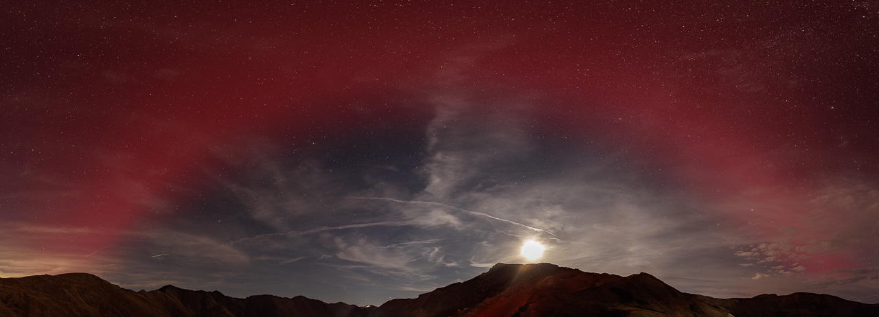
On this night, the arc was visible for most of the time that I was on Loveland Pass photographing the aurora, despite some cloud cover to the south. While most of the dozens of people on the pass had their cameras trained to the north, more than one person looked at me funny or commented that ‘the aurora isn’t that direction’ while I was shooting panoramas… thus the significance and uniqueness of this image. YEs, I’m a panorama guy! This composite is made up of ten 14mm (vertical images), and spans approximately 200° in width (~70° in height), nearly centered on due South. This image allows one to better visualize what is going on with the arc, the blue sky representing areas of the atmosphere that are not being affected by the energy of the aurora. As one stood looking south in this case, we were sort of looking into the lee side of the energy opposite the sun, effectively seeing the shadow of the earth, ‘downstream’ where little geomagnetic energy was present to heat the atmosphere. The almost perfectly circular/symmetrical nature of the SAR arc as presented in this panorama leads me to name the image: “Earth Shadow v2”.
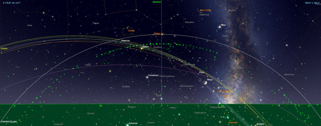
The following screenshot from SkySafari Pro shows the same portion of the sky at the time the images were captured. Note that the curvatuire of the Celestial Equator almost perfectly follows the curvature of the SAR Arc, which became visible at ~40° elevation when looking south (I don’t know if there is a relationship with my location having [coincidentally?] been 40°N latitude).

Lastly, a couple of panoramas captured about an hour before, during the height of the geomagnetic substorm that occurred from around 2000-2040 hrs MDT. During this time the sky was incredibly bright, and changing rapidly… almost flashing as seen in the timelapse video from my other aurora post here). The first is panoramic image is looking north; the second is looking south, during roughly the same timeframe. Note the duplicated cloud formations at left (north) and right (south) edges, the difference in the opposite corners is how much the aurora changed in the time it took to capture the 360° of panoramic images.
Another little-documented and understood aspect of strong geomagnetic substorms concerns proton pulses, often green patches glowing in isolated portions of the sky, sometimes during less energetic events than this one. Note the nearly symmetrical patches of green aurora in both images below, taking into consideration that nearly 180° separates them (i.e. they are on ‘opposite’ sides of the sky). I’m no solar physicist to be sure, but it is possible that these areas represent the effects from the higher-energy portion of the ring current (the center of the ‘donut’ of electrical energy surrounding the earth).


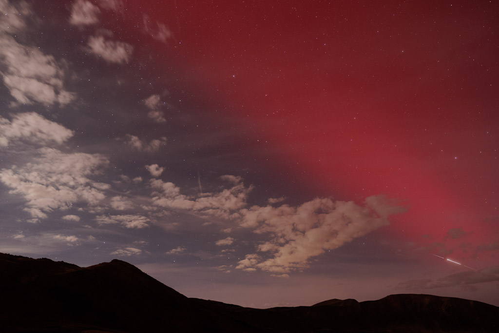
Actually really lastly, here is a single frame looking at the SAR arc in the WNW, with a three-frame composite of a Starlink satellite flare in the lower right corner:


